Linker AI Nexa Brings Physical AI to Smart City Governance
Linker Vision has unveiled Linker AI Nexa, a new platform designed to help city authorities use artificial intelligence to move from monitoring urban conditions to coordinating operational responses. Launched at the Smart City Expo World Congress 2026 in Barcelona on November 3, the platform combines Physical AI, agentic AI and digital twin technologies to connect real-time information from cameras and IoT sensors with government operating procedures.
The system is designed to help authorities assess situations, predict possible outcomes, identify the teams responsible for responding and coordinate action across departments. Its initial applications will focus on public safety, flood and typhoon response, urban resilience and sustainability.
The launch reflects a broader shift in smart-city technology. While conventional systems have largely focused on collecting information through cameras, sensors and connected infrastructure, newer AI platforms are attempting to interpret that information and support decisions across multiple government departments.
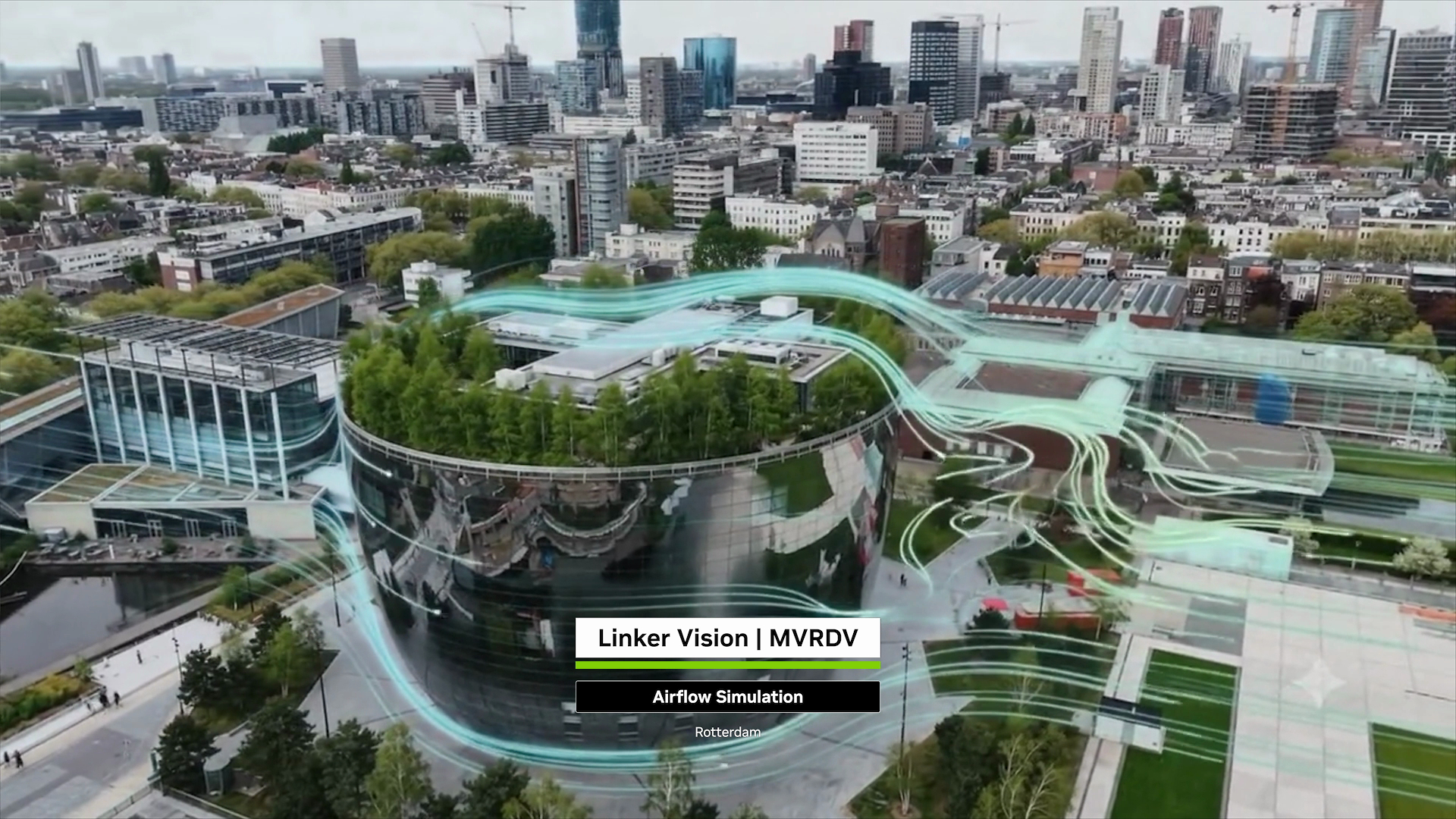
Linker Vision is also collaborating with Dutch architecture and urban design firm MVRDV to develop AI-powered digital twins for urban planning and climate adaptation, extending the platform’s potential applications beyond city operations.
Linker AI Nexa Connects Physical AI With City Governance
Linker AI Nexa is built around four stages designed to connect real-world information with municipal decision-making.
The first stage, Sense, interprets data from live cameras and IoT sensors to understand conditions across an urban environment. Predict uses simulation and environmental models to assess potential outcomes. Decide identifies the relevant government teams and recommends responses based on established standard operating procedures. Finally, Act coordinates workflows and triggers responses through connected systems.
This approach is intended to address a common problem in city administration: information is often spread across departments and separate technology platforms. A flooding incident, for example, may affect road traffic, drainage infrastructure and public safety at the same time. If the departments responsible for these areas operate independently, coordinating an effective response can become difficult.
By connecting information and operational procedures, the platform aims to help authorities develop a more unified view of incidents and coordinate responses.
The architecture draws on NVIDIA technologies, including the NVIDIA Metropolis Blueprint for video search and summarisation, NVIDIA Cosmos foundation models for understanding real-world conditions, and NVIDIA Omniverse libraries and OpenUSD for digital twin development. NVIDIA Nemotron reasoning models also enable users to explore scenarios and make planning adjustments through natural-language interactions.
The company says the platform includes security policies and operational controls to govern AI-driven actions, an important consideration when technology is being applied to public infrastructure and government operations.
Linker AI Nexa Targets Flood Response and Urban Resilience
One of the initial areas of focus is disaster response, particularly flooding and typhoons. Linker Vision plans to build on its experience in monitoring road hazards and traffic incidents through its city-scale Lighthouse Project with the Kaohsiung City Government in Taiwan.
The objective is to use real-time information and AI-based reasoning to help authorities understand how an incident may affect surrounding infrastructure and determine which agencies need to respond.
For example, information about flooding on a road could be relevant to traffic management, emergency services and water resource departments. A coordinated system could help identify the affected area, assess the potential impact and direct the relevant teams towards an appropriate response.
The announcement builds on Linker Vision’s wider work in smart-city infrastructure. The company’s existing deployments in Taiwan have involved the use of computer vision, video analytics and digital twins to improve situational awareness across urban environments.
However, the extent to which the new platform will be deployed across additional cities will depend on local infrastructure, data access, government procedures and integration with existing systems.
Linker Vision and MVRDV Bring AI Digital Twins to Urban Planning
Alongside the platform launch, Linker Vision announced a collaboration with MVRDV to explore how AI-powered digital twins can support urban planning and climate adaptation.
The partnership combines MVRDV’s urban design expertise and scientific evaluation criteria with Linker Vision’s digital twin and AI capabilities. One of the initial applications involves urban forests, where planners can identify areas experiencing high temperatures, evaluate tree-planting options and simulate the potential impact of greenery before implementing changes.
In Taipei, the companies have demonstrated an urban forest planning application using 3D Gaussian Splatting, a technique that can reconstruct detailed three-dimensional environments from photographic data.
According to the companies, the system has increased tree survey throughput from approximately 100 to more than 1,000 trees per person per day. Pilot simulations also indicate that projected shade coverage could rise from 15.7% to more than 50% over a 15-year period.
The platform can simulate these long-term outcomes in approximately 10 minutes, while multiple design iterations can be evaluated within an hour, compared with around two weeks for each iteration using the earlier process.
These figures are based on the companies’ pilot applications and projections, rather than independently verified city-wide outcomes.
The collaboration is intended to help planners assess the likely impact of climate adaptation measures before committing resources to physical projects. This could be particularly relevant for cities dealing with rising urban temperatures, limited green spaces and the need to improve public environments.
Linker Vision Expands AI Urban Planning Opportunities Across Europe
Linker Vision and MVRDV are exploring opportunities in Poland, the Netherlands, Ireland and Berlin, Germany. The partners intend to extend the digital twin approach beyond urban forests into areas such as residential communities, urban regeneration, public spaces and rooftop utilisation.
The shared platform is based on a build-once, reuse-many-times approach. Rather than developing an entirely separate technology foundation for each urban application, the companies aim to adapt common digital twin infrastructure to local data, planning priorities and governance requirements.
This could make it easier to apply the same underlying technology to different city challenges, although each implementation would still require suitable data, local expertise and integration with existing planning systems.
“Cities need AI that turns information into action and delivers measurable value,” said Paul Shieh, Founder and CEO of Linker Vision.
The launch at Smart City Expo World Congress 2026 highlights how AI is increasingly being positioned as an operational tool for city management, rather than simply a technology for collecting and analysing information. The next test for platforms such as Linker AI Nexa will be their ability to translate simulations and AI-generated recommendations into reliable, measurable improvements in how cities function.